Aerial View of Phan Rang Air Base
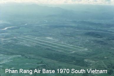
The Runways and Taxiways run North-South as seen from this aerial photo taken over the coast of the South China Sea, which is East of the Air Base about 5 miles distant. West of the base, in the background of the photo, can be seen the Annamite Mountains which run from northern Vietnam around Hanoi almost to Saigon in the south. Also visible in the photo, in the upper left, is the River which flows from the generating plant at the base of the mountains, then south of the Air Base and city of Phan Rang (not visible, to the left of the photo) on its way to the South China Sea.
CLICK to continue